The Best Road, Gravel, and Mountain Biking Routes in the USA
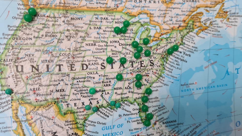
The United States is made up of some of the most beautiful and diverse landscapes in the world.
Within the 50 states, there are thousands of amazing cycling routes to choose from. These roads, trails, and paths range from just a few miles to hundreds of miles in length, offering something for every kind of cyclist.
In this article, we’ve chosen 25 of our favorite road, mountain, and gravel cycling routes, listed by region. With so many routes to choose from, it was difficult to narrow down the list to just 25. If you don’t find the state you’re looking for here, be sure to research further for your next trip.
Biking Routes in the West
Black Canyon Mountain Bike Trail, Arizona

Located at the foothills of Arizona’s Bradshaw Mountains, the 80-mile long Black Canyon MTB Trail offers a tough yet rewarding riding experience.
This singletrack trail follows a pre-historic Native American trading route that traverses the Sonoran Desert. It passes soaring canyons and hoards of the iconic saguaro cactus.
The route has an intermediate to difficult rating. It is characterized by rough terrain of loose dirt and rocks and steep gradients. Additionally, the harsh desert climate makes it even more difficult.
The average grade of the trail is 3% with ramps of up to 20%, adding up to a total of 4,500 feet of elevation gain. It is best to ride the trail between November and April, to avoid the peak heat of summer.
Mt. Tamalpais Loop, California
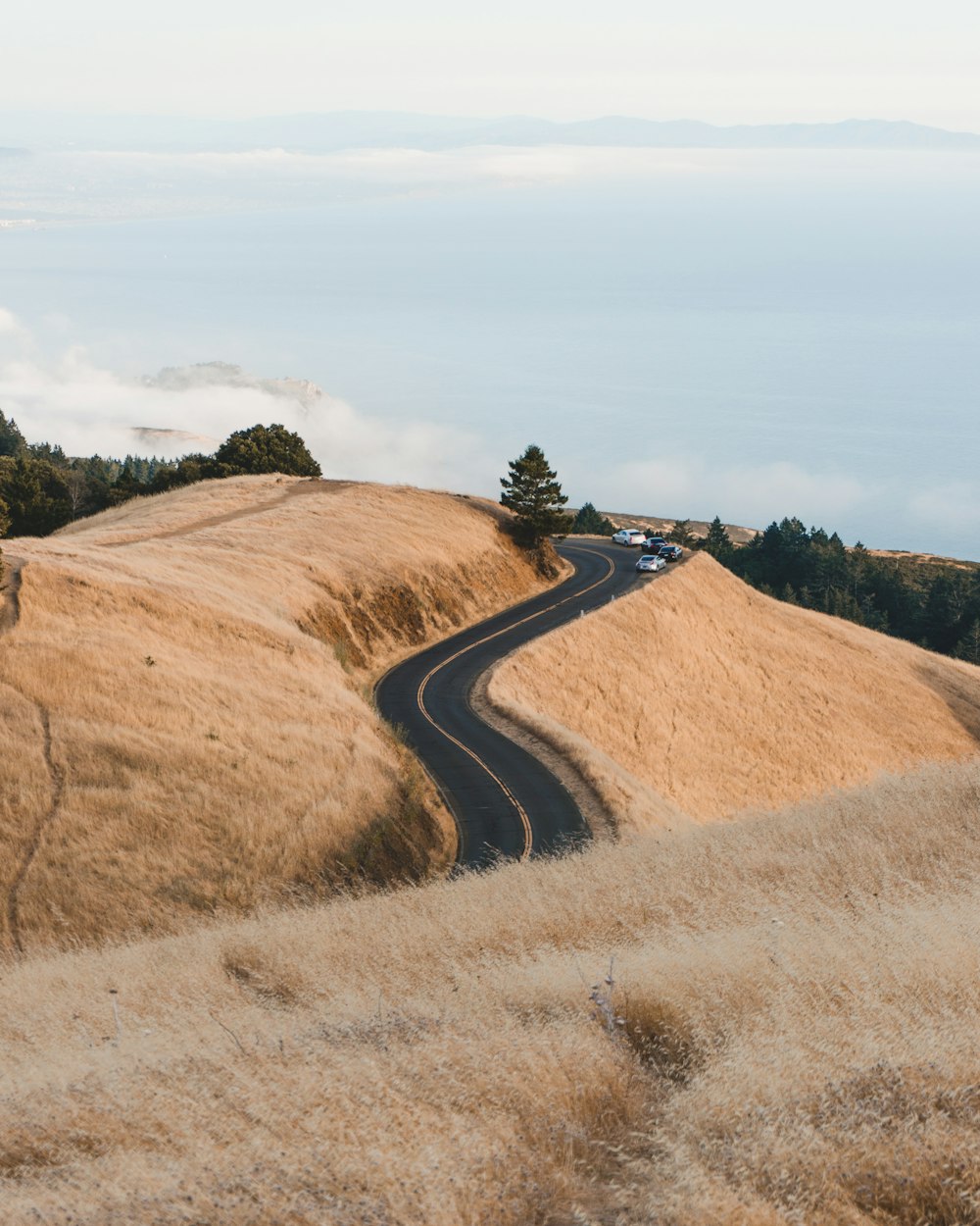
The challenging yet rewarding 32-mile Mt.Tamalpais loop is regarded as one of California’s must-do cycling routes. The road-based loop traverses much of Marin County, starting and ending in Fairfax.
Along the way, riders can see breathtaking views of the Pacific Ocean, glimpses of the Bay area (on a clear day), and the lush green pines of Tamalpais State Park. The route consists of several steep climbs which total over 3700 feet of elevation gain.
For any riders who like a challenge, there is a six-mile out and back climb to East Peak along East Ridgecrest Boulevard. It takes you to the summit where you can experience an awe-inspiring view of the coastline. Additionally, there are picnic tables and a visitor’s center at East Peak to take advantage of when you arrive.
Trail 401, Crested Butte, Colorado
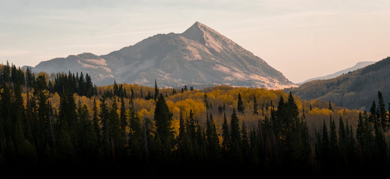
Trail 401 in Colorado is an iconic 15.4-mile mountain bike loop that brings riders through alpine meadows and features stunning 360-degree views of Colorado’s Elk Mountains and crystal clear lakes.
This route is rated by Mtbproject.com as intermediate to difficult, and tops out at an altitude of over 11,000 feet. Due to extreme weather almost year-round, this trail doesn’t open until July, and can still feature patches of snow in the dead of summer.
The singletrack begins about 7 miles in and runs down the mountain with a series of technical sections which are what makes the 401 such an exciting trail. Finally, the whole route includes 2250 feet of climbing with similar altitude loss, and you will experience ramps of up to 29%.
Mt. Evans Road, Colorado
The famed Mt.Evans climb in Colorado has earned the state a second place on our list.
The route rises over 14,000 feet above sea level, making it the highest paved road in North America. At this altitude, expect chilly weather and sudden changes in conditions. For these reasons, the route is only open during the summer season.
The average gradient of the climb is only 4.5% over the 27.4 miles, clearing 6,744 feet of altitude gain, with the steepest sections at about 10%. Although this isn’t the steepest climb, the air is notably thin, making 4.5% feel significantly more difficult.
At the top, you can take in the spectacular vistas above the treeline, passing beautiful lakes and forests on the way. Additionally, keep an eye out for wildlife, including wild mountain goats.
Bald Mountain, Sun Valley, Idaho
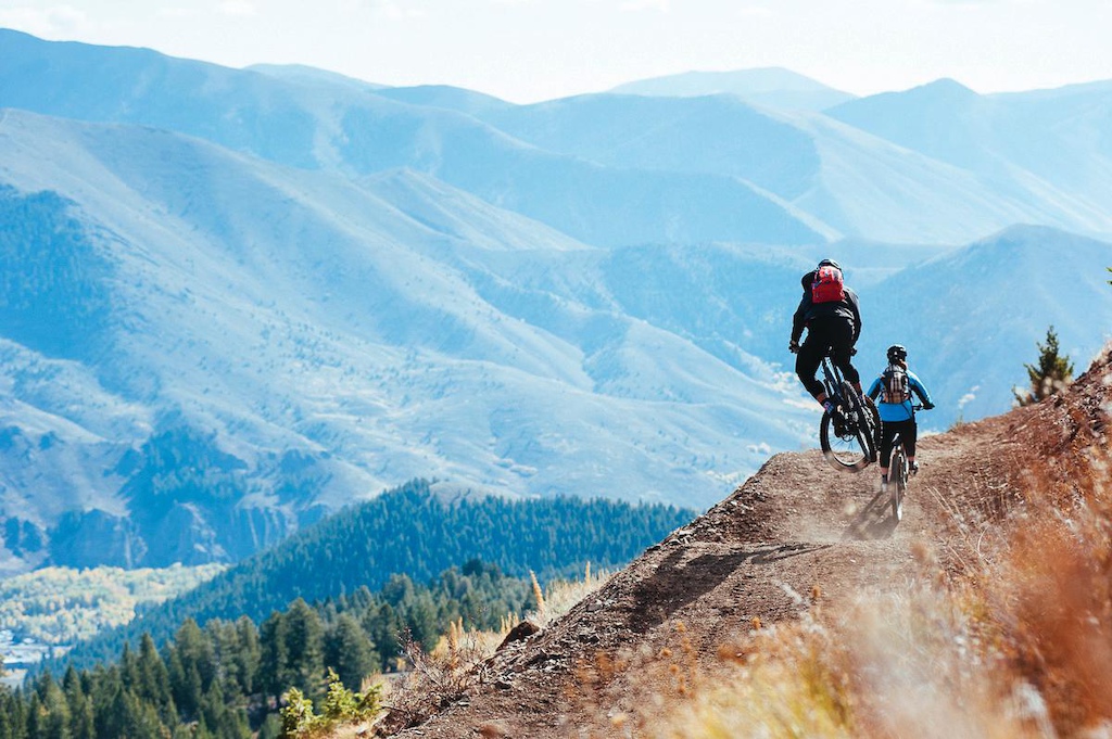
Sun Valley in Idaho is one of the country’s premier mountain biking destinations. It features over 400 miles of singletrack as well as 30 miles of paved road. This park truly has something for every type of cyclist.
One of the most notable mountain biking routes in the valley is Bald Mountain. This route can be accessed by ski lift courtesy of the Sun Valley Resort.
The 9.5-mile route starts at over 9,000 feet and drops 3,400 feet along three connected trails to the valley floor, comprising one of the country’s longest flow trails.
Going-to-the-Sun Road, Glacier, Montana

Montana’s Glacier National Park is home to one of the USA’s most unique cycling routes. The Going-to-the-Sun Road is only 50 miles long but features a huge 32-mile ascent.
Going from west to east, the route starts at the Apgar visitors center and rises over Logan’s Pass. Once you have reached the top of the pass at over 6,600ft of elevation, you begin a long descent to the east entrance of the park.
The 15 Best National Parks for Cycling (U.S.)
Along the way, you will catch glimpses of Glacier National Park’s jaw-dropping beauty. This includes its namesake ancient glaciers, towering peaks, crystal clear lakes, and endless forests.
Each spring, there is a period where the park is closed to motor vehicles, but open to cyclists (you can check the road status here), making this the best time to visit as a cyclist.
There are quite a few rules and restrictions in the park at different times of the year, so always make sure to check the park’s website when planning your visit.
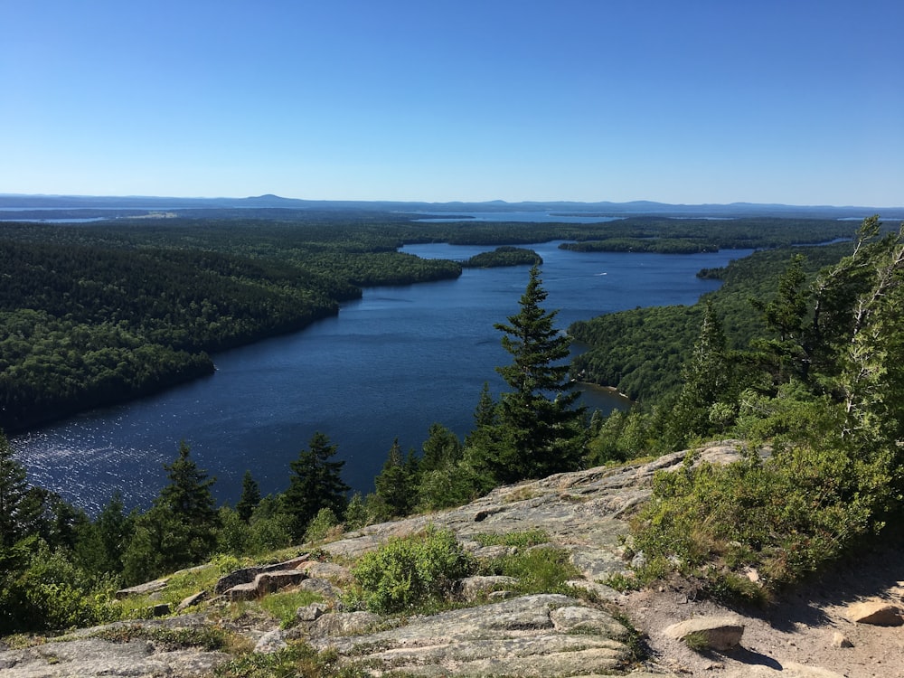
Tahoe Rim Trail, Nevada
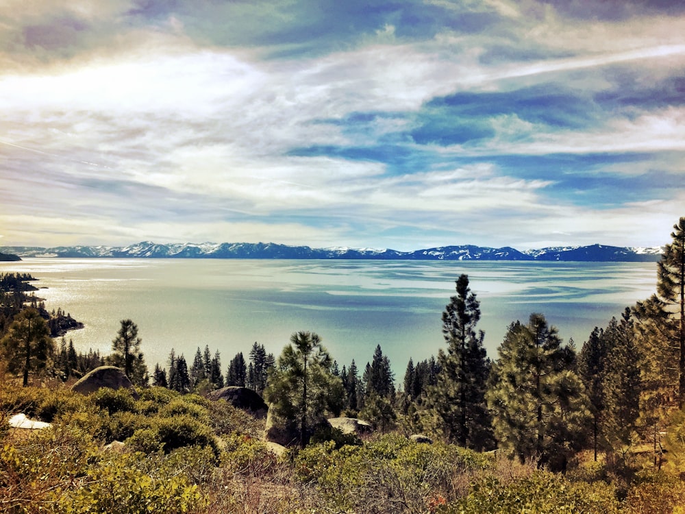
Nevada’s Lake Tahoe is North America’s largest alpine lake. This vast body of water draws people from all over the world for an array of outdoor adventures all year round.
Around the perimeter of the lake, you can find a 165-mile trail with 80 miles open to mountain bikes. Along the trail, there is a mix of pristine singletrack, steep climbs, and rapid descents with plenty of breathtaking views scattered throughout.
On the Tahoe Rim Trails website, you can see a number of trails of varying difficulties and lengths. The routes have a mix of peaks, waterfalls, meadows, and lake rides. Before traveling, make sure to check the website for restrictions and trail conditions as the weather in the area can be quite extreme.
High-Desert Trail System, New Mexico

The High-Desert Trail System is a series of singletrack mountain biking loops situated North of Gallup, NM. The three loops offer different levels of challenges, with beautiful views of the desert landscape and rocky mesas to reward those who dare.
The most popular of the three routes is the 3rd and 2nd Mesa Loop just shy of 14 miles in length. This challenging loop has steep gradients of up to 14%, climbing a total of 853 feet throughout, as well as technical sections and short but fast descents.
The trail itself is well maintained and signposted, and open year-round. This area has extreme heat in the summer, so make sure you are well prepared for your trip with plenty of water and food.
Crater Lake Loop, Oregon
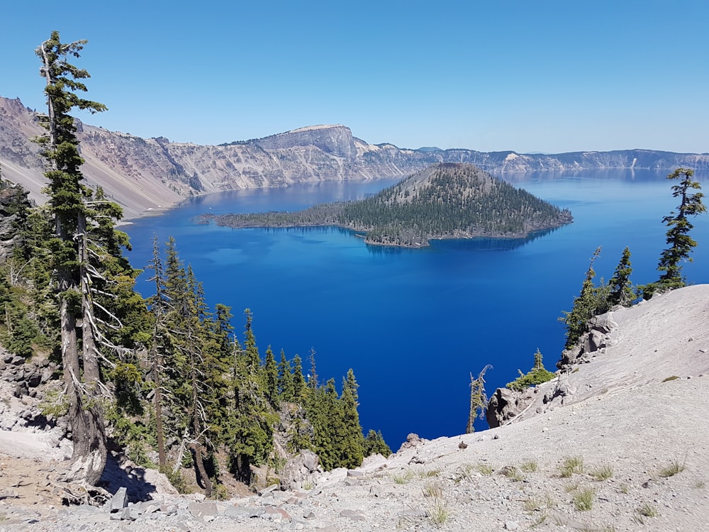
The loop around the ancient volcanic lake at Crater Lake National Park is one of the “must-do” rides on the west coast of the United States.
This challenging 33-mile route is a constant string of climbs and descents that passes 30 unique viewpoints, covering a total elevation gain of 3,900ft.
Crater Lake is the deepest lake in the USA and stretches 6 miles across. It is characterized by its crystal clear water and beautiful rugged surroundings.
Rim Drive Road is only open between May and October due to extreme weather conditions. During that time mountain bikers can take advantage of the non-motorized 8-mile Grayback Drive trail for an off-road experience.
Additionally, on two Saturdays each year, the loop is closed to motorized traffic for the “Ride the Rim” cycling event, a unique experience to enjoy this otherwise busy road without vehicles.
The Whole Enchilada, Moab, Utah
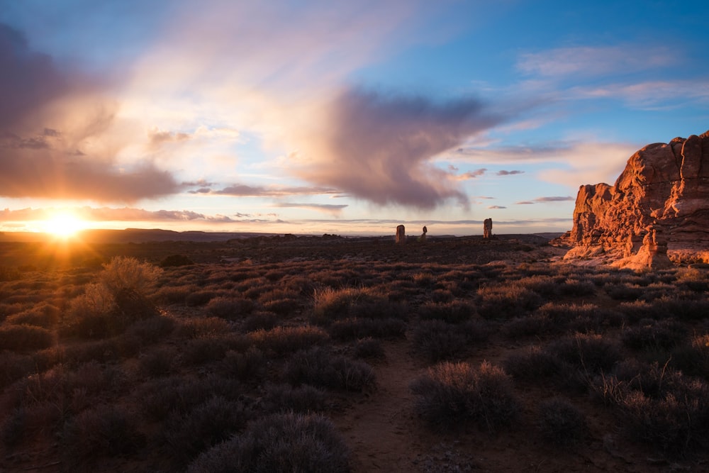
The Whole Enchilada ride at Moab is a 34-mile mountain biking trail of which 50% is singletrack.
This spectacular trail offers the best of what Moab has to offer, descending from the soaring alpine treeline down to the lush red sandstone canyon floor.
Along the route, you will experience a little of everything including wooded singletrack, jagged trails, and paved bike path.
The Whole Enchilada is very technical, with almost 8,000 feet of descending and 1,300 feet of gain. The trail climbs to 11,000 feet altitude with segments reaching over 20% gradients, overall giving it a rating of ‘difficult’ from the MTB Project.
Yellowstone’s Grand Loop, Wyoming
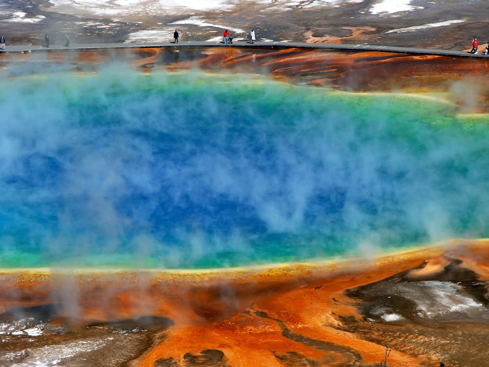
Yellowstone National Park is one of the most spectacular natural parks in the northern hemisphere, characterized by its famous geysers and diverse wildlife.
The segment from Madison Junction to the exit for the Old Faithful area is the most popular part of the loop. It passes several notable geyser basins along 16 miles of the pristine park road.
If you want to extend the route, be sure to take the detour along Firehole Lake Drive for some spectacular eruptions, a waterfall, and hot springs.
This area is fully paved and mostly flat, making it a great choice for any fitness level. As the park experiences extreme weather, be sure to check the road closures before visiting in the spring or fall seasons.
Biking Routes in the Midwest
Illinois Prairie Path, Illinois

Illinois’ Prairie Path is a scenic 61-mile multi-use path that runs through the northeastern part of the state. The trail is open only to non-motorized traffic.
This path was the first rail-to-trail conversion in the United States beginning in 1961. The route is fully serviced with amenities including rest areas, water fountains, garbage cans, wildlife refuges, and more.
Along the way, enjoy the beautiful prairie countryside, local wildlife, and old prairie restorations like bridges and train depots.
The path is mostly flat and is suitable for riders of all ages and abilities. This makes it an excellent route to take the family along.
Cardinal Greenway, Indiana
In 1993, conversion began on the Cardinal train route across 60 miles of Indiana. Today, it is the longest rail-to-trail conversion in the state. It is a mostly flat route full of beautiful nature and helpful amenities.
Along the route, there are several toilets, water fountains, bike maintenance stations, and historical points to check out. Also, make sure to soak up the gorgeous Indiana countryside throughout.
It’s worth noting, although the trail is mostly flat, that wind conditions across the prairies can make the journey much more difficult, so be sure to check the weather before you head out.
If you end up in the area without your bicycle, you can take advantage of the Cardinal Greenways’ Community Cruiser Program, which allows you to rent bikes for free for use on the trail.
Flint Hills Nature Mountain Biking Trail, Kansas

The Flint Hills trail covers 117 miles of Kansas countryside passing through numerous towns and cities. Visitors will enjoy tallgrass prairies, lush forests, and ride alongside the rapids of the Marais Des Cygnes River.
This mountain biking rail-trail is the seventh longest in the USA forming an integral part of the coast-to-coast American Discovery Trail. The trail itself is open year-round and only to non-motorized traffic.
Along the trail, adventurers encounter an array of beautiful viewpoints, historical sites, wildlife, and recreational areas. This easy-rated trail is mostly flat with some light climbing spread throughout, totaling a mere 1,545 feet from start to finish.
Root River State Trail, Minnesota

Biking Minnesota’s Root River trail is the perfect way to spend a day or two when visiting the area.
Covering 60 miles, this paved trail passes through peaceful wooded areas, towering limestone bluffs, and rolling plains along an abandoned railroad bed. While riding, be sure to keep an eye out for Minnesota’s diverse flora and fauna.
Along the trail and in the trail towns, riders will encounter various lodgings, restaurants, old historical buildings, campgrounds, and museums. Because this route is mostly flat and almost fully supported, it’s the perfect place to take the family on an outdoor adventure.
The Katy Trail, Missouri

Missouri’s Katy Trail is the longest rail-to-trail route in the US. It covers a distance of just under 240 miles, essentially covering the whole width of the state.
The trail forms part of the American Discovery Trail which will eventually connect the east and west coast of the country. It is open to visitors from April 1st through to October 31st each year.
For riders planning multi-day trips along the route, there are plenty of options for accommodation and camping in the towns the route passes through.
The route itself is very flat and the road is crushed stone, so gravel tires are recommended. Riders can expect stunning prairie countryside, endless forests, and historical monuments marking this section of the Lewis and Clark historical trail.
Maah Daah Hey Trail, North Dakota

The Maah Daah Hey Trail is a 144-mile singletrack trail that showcases some of the United States’ most awe-inspiring landscape across the badlands of North Dakota.
While riding the Maah Daah Hey, expect to see soaring peaks, sprawling valleys, beautiful prairie countryside, snaking rivers, and diverse wildlife combining to make for an unforgettable trip.
The trail itself is well-serviced with 10 campgrounds spaced every 20 miles or so. The system contains eight unique segments that are broken down in detail on the trail association website. Among the trail segments, there is something for every type of mountain biker and the trail is open year-round.
Ohio & Erie Canal Towpath Trail, Ohio

Located in Ohio’s Cuyahoga Valley is an 85-mile long horse and cart Towpath Trail which follows the route of the canal built in the early 1800s.
On the route, you will encounter various historical sites and beautiful scenery, giving riders plenty to see and do along the way. Visit some of the historical monuments to learn more about the history of the canal and how it was built.
The terrain itself is not very difficult, but the trail is long and can be very rough at times. As it is made of compacted gravel, road bike tires are not appropriate.
The park can be enjoyed year-round except for some minor closures due to maintenance and weather, always be sure to check the park website before visiting.
Biking Routes in the Northeast
Old Carriage Roads, Acadia National Park, Maine
Acadia National Park is home to a 45-mile web of old carriage trails made from crushed rock that provide one of the best off-road biking experiences on the East Coast.
The Old Carriage Roads are littered with stunning viewpoints, waterfalls, stone-faced bridges, and steep cliffs, creating a wonderful experience no matter where you end up.
These roads are accessible from various points, meandering the mountains and valleys that characterize this magnificent park. Within the network of trails, there are a wide variety of routes to choose from, including steep mountain climbs to relaxed valley sections.
This system of roads is closed to vehicles year-round and closed to bicycles during the winter. Visitors on two wheels can take advantage of the ‘Island Explorer Bicycle Express’ which takes riders across the water from Bar Harbor Village Green to Eagle Lake.
Mt. Greylock Loop, Massachusetts

Mt. Greylock is the highest mountain in the state of Massachusetts, reaching 3,489 feet.
The loop begins and ends in Williamstown, covering 37 miles. The route has 3,400 feet of climbing and an equal descent back to the starting point. Throughout the climb, you can expect max gradients of over 12%, making this climb a great challenge.
This tough test is rewarded with lots of breathtaking views along the ascent, culminating with a panoramic view of beautiful southern New England, with visibility of up to 90 miles on a clear day.
Great Allegheny Passage, Pennsylvania
The Great Allegheny Passage is a wonderfully diverse 150-mile trail, most of which is converted from old abandoned rail beds.
This vast pathway runs by three different rivers, crosses valleys, and winds around mountains all with an average gradient of less than 1%, making this trail very family-friendly. The highest point on the passage is the top of the Eastern Continental Divide at 2,392 feet.
Along the way, you can take advantage of trail towns located roughly ten miles apart to stock up on ride essentials or stop for the night. Other notable features of the trail include tunnels, viaducts, and a bone cave.
The trail itself is made from a crushed limestone surface, meaning it can be ridden on road bike tires. However, if it is wet and soft, it can be difficult to ride on thin tires.
Biking Routes in the South
Oak Mountain State Park, Alabama

Oak Mountain Park is Alabama’s largest park with just under 10,000 acres of stunning countryside. Within the park itself, there are 30 miles of mountain biking trails.
Most of the trails here are rated for intermediate-level riders, however, the Lake Trail is suitable for beginners. Advanced mountain bikers can challenge themselves on Blood Rock or BUMP Trail.
The most popular trail within the park is the Red Trail (The Double Oak Trail). It mixes 22 miles of tight singletrack and doubletrack sections with 1,600 feet of climbing throughout. This route has also been recognized by the International Mountain Bike Association on their list of Epic Rides around the world.
Each year from September to May, the park opens the trails up for night rides. This allows visitors to enjoy the challenge of tackling the trails in the dark.
Arkansas River Trail System, Little Rock, Arkansas
Arkansas’ River Trail Grand Loop spans an enormous 88 miles through urban areas, woodlands, and open plains.
The route displays the best of central Arkansas both urban and rural. It connects 38 parks and six museums within the metropolitan area.
This mostly flat route is suitable for people of all ages and abilities. Along the way, there are plenty of opportunities to stop and enjoy the diverse landscapes. Riders can also take advantage of two bicycle stations along the route to make repairs and adjustments.
The terrain consists of paved trails, bike lanes, and rural roadways. Additionally, throughout the whole 88 miles, there is a total of 4,018 feet of elevation gain, with most of that coming between Roland and Wye.
Atchafalaya Basin Wilderness Trail, Louisiana

This gravel trail covers 55 miles of Atchafalaya Basin from Henderson to Franklin. It takes riders on a beautiful and rustic path along a levee.
The whole route is almost completely flat and set in nature, making for one of the most tranquil rides in the country.
Finally, this remote trail is mostly unsupported meaning riders must ensure they have everything they need for the duration.
Natchez Trace Parkway, Mississippi
Completing a section of the 444-mile Natchez Trace Parkway is one of the must-do trips for cyclists in the United States. The whole distance is designated as a cycling route by the National Park Service. Commercial traffic is prohibited and there is a speed limit of 50mph.
This vast road crosses three states, including Mississippi, Alabama, and Tennessee without stop signs or traffic lights, creating one of the most tranquil experiences in cycling.
Along the way, riders can take advantage of rest stops every 20 miles, as well as bike-only campsites, bike-friendly lodging, and countless historical and natural points of interest.
The whole 444 miles of the parkway are relatively untouched by industry. This allows cyclists to enjoy peaceful wooded areas, sprawling farmland, and beautiful creeks. Finally, the best time of year to visit is in the spring or fall, as temperatures can be very hot in the summer.
Read Next
Best Touring Bikes to Travel the World
Share this on: